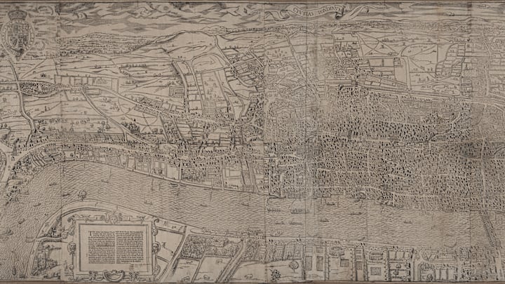
Britain's capital has undergone some dramatic changes over the centuries. Before structures like the Gherkin, the London Eye, and even Big Ben loomed over the city, it was home to bear-baiting pits and fields for livestock. Now, modern residents and tourists can see what it looked like 450 years ago when the oldest complete map of the city goes on display for the first time, TimeOut reports.
Civitas Londinium, also known as the Woodcut or Agas map, dates back to the 1570s. It was made by an unknown designer, and only three prints survive today. It's been the subject of serious conservation efforts since the 16th century, helping it stay intact while many maps from the era have degraded.
The artifact will be displayed to the public as part of the "Magnificent Maps of London" exhibition at the London Metropolitan Archives. Visitors will have a chance to see other cartographic objects from the city's history, like maps tracing the spread of infectious diseases in the 19th century.
Another survey in the collection, titled the "Ruins of London," was commissioned by the City of London Corporation immediately following the 1666 Great Fire of London. More than 13,000 houses were destroyed in the blaze, and the survey was an early step in city's the reconstruction plan.
"Magnificent Maps of London" will be free for the public to view from Monday, April 11 through Wednesday, October 26. Here are more resources for studying important maps from history.
[h/t TimeOut]
