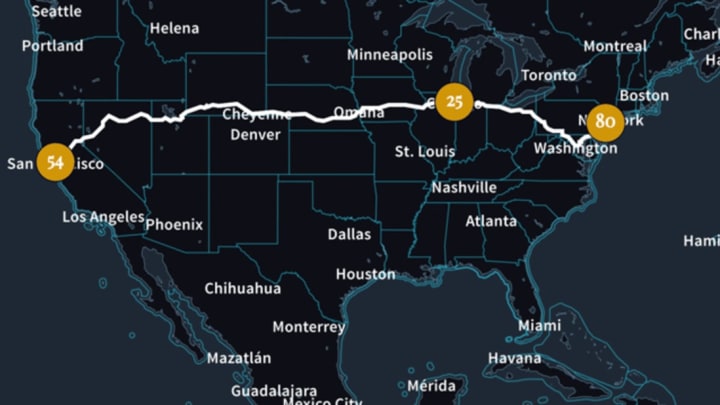
In 1900, eleven years after Michelin was founded, the tire company released its first city guide as a way to promote travel to its customers. In the spirit of the guide’s origins, Orbitz has published a map plotting the fastest way to visit every Michelin-starred restaurant in the U.S. by car.
America is home to a number of areas with the most Michelin-starred restaurants on Earth—including the San Francisco area, which boasts more than 50 stars spread out across more than 30 establishments, and is where this road trip starts. After knocking out the California spots, drivers take a 2111-mile trip to Chicago, where 26 Michelin-starred eateries await them. After that, there are two culinary destinations left to visit: New York City, which has more stars than any other city in the U.S. (with 77), and Washington D.C., which received its first Michelin guide this year. Even though the restaurants are concentrated in just four states, the sheer number of restaurants on the list means that if you ate at a different one each night, it would take you five months to try them all.
The road trip is 3426 miles in total, with the optimal distance calculated by road trip wizard Randy Olson (you may be familiar with his epic National Park route or his “Where’s Waldo?” search algorithm). You can check out an interactive version of the map, complete with each restaurant's name, address, and total number of stars, at Orbitz.com.
