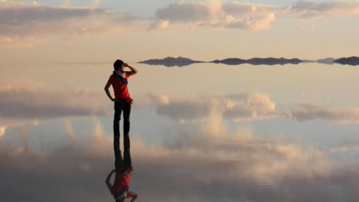
The Earth is home to some pretty extraordinary destinations. Some, like a reflective salt flat that stretches thousands of miles, definitely deserve a spot on your travel bucket list. But others, like the coldest corner of Antarctica, are best appreciated from a distance. Here are seven of the most extreme environments on the planet.
1. THE HOTTEST // LUT DESERT, IRAN
The title of world’s hottest place is a subject of heated (pun intended) debate. California’s Death Valley claimed the record when temperatures reached 134°F on a summer’s day in 1913. Nine years later, El Azizia, Libya surpassed that figure by two degrees—a record that still technically stands today. But weather experts claim that temperatures get much more extreme elsewhere on the planet. In Iran’s Lut Desert, for instance, the climate is so severe that it would be impractical to maintain a weather station there. Scientists have found an alternative way to measure the surface temperature using infrared satellite imagery. After looking at five years of data, the Lut Desert consistently came in as the world’s hottest spot. In one particularly hot year the temperature measured in at a blistering 159.3°F.
2. THE COLDEST // EAST ANTARCTIC PLATEAU
It’s no shock that all the extreme cold records belong to Antarctica, but just how low temperatures can dip in our southernmost continent may be surprising to some. In 1983, temperatures outside Russia's Vostok research station on the East Antarctic Plateau plummeted to 128.6 degrees below zero—about 20 degrees colder than dry ice. Scientists believe that the alarming drop in temperature was the result of a combination of a lack of warm air that normally flows in from the southern ocean and the flow of cool air circling the station. No colder temperatures have been recorded on the ground since, but in 2013 satellites detected temperatures bottoming out at -135.8 degrees in that same area of Antarctica.
3. THE DRIEST // ATACAMA DESERT, CHILE
It’s not unusual for years to go by before a single drop of rain hits Chile’s Atacama Desert. The arid landscape earned the distinction of world’s driest place after sustaining a 173-month-long dry spell in the early 20th century. On average it receives 1 millimeter of rain a year—to qualify as a desert, an area must receive an average of no more than 250 millimeters a year. There are corners of the desert where rainfall has never been recorded, and local residents who have never witnessed the phenomenon with their own eyes. There are three main factors contributing to the Atacama’s exceptionally dry conditions: Its position west of the Andes places it in a “rainshadow,” with all the moisture carried by the ocean winds ending up on the wrong side of the mountain range; the winds that blow over it from the neighboring Pacific are unusually dry to begin with; and lastly, its position south of the equator creates high air pressure, causing any moisture in the air to evaporate. Any one of these conditions alone would be enough to create a dry climate, and together they create the perfect (rainless) storm.
4. THE RAINIEST // MAWSYNRAM, MEGHALAYA, INDIA
Anyone planning a trip to the Indian village of Mawsynram would be wise to bring an umbrella. Located in the state of Meghalaya, or “land of the clouds,” the spot receives an average of 467 inches of rainfall a year. For comparison, Seattle was drenched with just 44.83 inches in 2015. The high hills of Meghalaya create a tight space in the atmosphere that squeezes out rainwater from any clouds passing overhead. This results in roughly 320 days of rainfall a year in the area. It’s become such a common part of life that people working outside often suit up in fully-body umbrellas made of bamboo and banana leaf.
5. THE MOST ELECTRIFYING // LAKE MARACAIBO, VENEZUELA
Visit the spot where the Catatumbo River meets Lake Maracaibo in Venezuela on any given night and chances are you’ll be treated to a light show. The lake sees 260 stormy days a year, and in peak season the Beacon of Maracaibo, or “everlasting storm,” produces 28 lightning strikes a minute. They even light up in a rainbow of colors thanks to dust particles and water vapor in the surrounding air. There are numerous theories as to the cause of the electrifying phenomenon: Uranium deposits in the ground there were once thought to attract lightning, and recently methane released from oil fields was believed to make the air above more conductive. Today it’s widely accepted that evaporating water from the lake, the topography of the surrounding Andes, and trade winds from the neighboring sea form the wicked storm clouds.
6. THE FLATTEST // SALAR DE UYUNI, BOLIVIA
Salar de Uyuni in Bolivia is remarkable for what it lacks: There’s not a peak or valley for over 4500 square miles. The salt flat was formed between 40,000 and 25,000 years ago after a large lake covering what is now southwestern Bolivia dried up. Today the desert is home to 10 billion tons of salt. Tourists come from all over to walk or drive across the flat terrain in the winter season or gaze at the massive reflecting pool that forms during the wet summer months.
7. THE MOST ISOLATED // BOUVET ISLAND, NORWAY
If you’re really looking to get away from it all, there’s no better place to be than Bouvet Island. The volcanic landmass is located in the South Atlantic halfway between Antarctica and South Africa. The closest human life is on Tristan da Cunha 1404 miles away, which just so happens to be the most remote inhabited island in the world. Bouvet Island is difficult to walk on, much less live on, but despite that, many people have tried to claim it for themselves. Today the 19-square-mile, glacial chunk of rock is a dependency of Norway.
