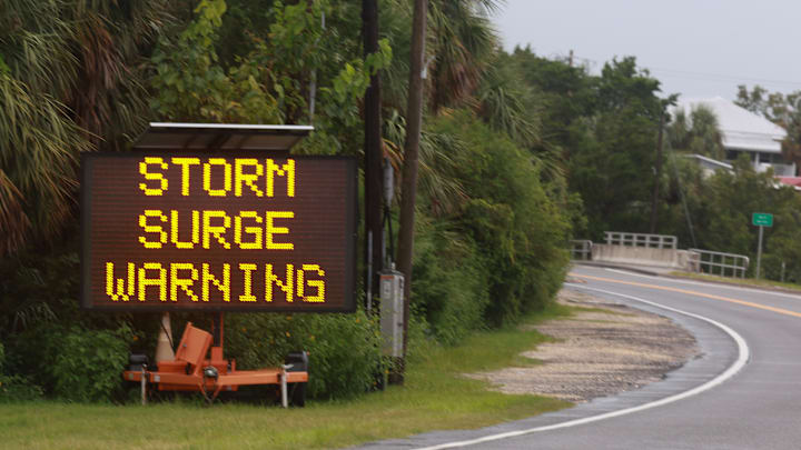
When you think of the danger a hurricane poses to the unlucky people caught in its path, your first thought is probably the ferocious winds that crash ashore and tear up just about everything exposed to the elements. While the winds are destructive and the flying debris is a serious hazard to anyone caught in the way, the greatest and quietest killer in a tropical cyclone is its storm surge. Here’s what you need to know about them.
- It’s a sudden inundation of seawater.
- Storm surges aren’t caused only by hurricanes.
- A storm surge’s tracking and timing determine its severity.
- Wind speed is an even bigger factor.
- Wind powered Superstorm Sandy’s devastating storm surge.
- Curvy coastlines amplify a storm surge’s destruction.
- Slow-moving storms do more damage.
It’s a sudden inundation of seawater.
The strong winds of a landfalling tropical cyclone thrust it inland. The flooding that results from storm surges is only a few feet deep most of the time, but the worst surges—like those seen in Hurricane Katrina—can exceed 20 feet or higher. A storm surge comes up quickly and can push water miles inland in the most vulnerable spots during the strongest storms.
Storm surges aren’t caused only by hurricanes.

Hurricanes are most closely associated with storm surges, but they’re not the only storms that can push water inland. Tropical depressions and tropical storms can also inundate coastlines if their winds are strong enough. Powerful winter storms can also generate a life-threatening storm surge. A blizzard that hit the East Coast in January 2016 produced a storm surge in Cape May, New Jersey, that was slightly higher than the one recorded there during Hurricane Sandy a few years earlier.
A storm surge’s tracking and timing determine its severity.
Meteorologists tell people not to focus on the exact track of a tropical cyclone since the impacts can extend hundreds of miles from the center of the storm. But when it comes to a storm surge, track really does matter. The worst winds in a storm occur in the right-front quadrant of its eyewall, or the part of the storm that’s in front of the eye and to the right of its forward movement. This spot sees the strongest winds influenced by the forward motion of the storm, and it’s where the wind is able to push the most water with it.
Timing also determines how much flooding people at the coast will experience. Coastal flooding will be worse if a storm hits land at high tide since water will be a few feet higher. That couple of feet at high tide doesn’t seem like much, but it can mean the difference between a few roads washed out and a few neighborhoods inundated by water.
Wind speed is an even bigger factor.
The fury behind the surge is wind. The National Hurricane Center claims that 95 percent of storm surge is driven by the wind—the other 5 percent is water that rises above sea level due to low air pressure at the center of the storm. A general (and obvious) rule of thumb is that a stronger storm will produce a more destructive storm surge, but surge also depends on other factors like a storm’s forward speed and the size of its wind field.
Wind powered Superstorm Sandy’s devastating storm surge.

Even though Hurricane Sandy had only 80 mph winds when it made landfall in New Jersey on October 29, 2012, it was one of the most destructive storms to hit the United States in recorded history. The devastating storm surge that Sandy drove into coastal communities was the result of the immense size of the storm’s wind field.
When Sandy made landfall, the area covered by its tropical storm force winds (39–74 mph) extended more than 1100 miles from South Carolina to Maine. The enormous area made up for the storm’s relative lack of concentrated intensity, allowing it to push tremendous amounts of water into the coast.
Hurricane Katrina’s historic storm surge along the northern Gulf Coast in August 2005 was also driven by the sheer size of the storm. Katrina was a massive hurricane with scale-topping category 5 winds to boot. Katrina weakened by the time it reached the coast, but the size of the storm and its former strength still pushed enormous amounts of water into Louisiana and Mississippi.
Curvy coastlines amplify a storm surge’s destruction.
As if getting hit with a bad storm weren't bad enough, the very shape of the coastline itself will determine how much of an impact a storm surge will have on coastal communities. Shallow waters offshore and concave bays and inlets will exacerbate a storm surge and make the inundation deeper than it would have been otherwise.
Slow-moving storms do more damage.
After Hurricane Hermine made landfall in Florida in 2016 and moved into the Atlantic Ocean, its impacts along the Mid-Atlantic and New England coastlines worried meteorologists because of how long they expected the storm to linger near land. Forecasts called for Hermine to meander off the coast of New Jersey at or near hurricane strength for four full days before beginning to dissipate. Thankfully, the worst-case scenarios didn’t come to pass, but the threat was real.
Even though Hermine wasn’t forecast to make another landfall, the exceptionally long duration of the storm—with powerful winds blowing inland for days at a time—threatened to generate a large storm surge along the coast. A slow-moving storm will cause more damage than one that moves through in a matter of hours.
Read More Facts About Weather:
A version of this story was published in 2016; it has been updated for 2024.
