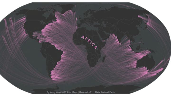
Breaking news: The Earth is round. OK, that may not be news to most, but how the shape of the planet affects one's perspective when looking out over the oceans may be. Science Alert recently shared a set of maps created by cartographer Andy Woodruff that challenge assumptions about what can be seen from any given coast. The maps feature lines that connect numerous coastal points with the coastal points that directly face them. Many of the lines appear to take circuitous routes around the globe, but according to Woodruff, that's the way the world works.
Woodruff used National Earth Data vectors (and the controversial Mercator Projection) to calculate angles and plot points along coastlines. He explains on his blog that "spherical straight" and straight as defined by compass directions are not the same, using the classroom demonstration of a string around a globe to illustrate the point. Woodruff writes that the azimuthal equidistant projection (a type of map projection) "preserves correct direction (and distance) from the center point of the map," which is why he used it to draw straight lines that more closely represent what someone's line of sight would be from the given points. "I’m not entirely certain that I have all the math right," Woodruff admits, "but I think it’s at least close. Even we cartographers sometimes have a shaky grasp of map projections and spherical geometry."
Check out Woodruff's maps below and notice how certain points along the East Coast of the United States connect with Australia, and how a few countries in South America are actually across from Madagascar, even though some map projections make it appear to be on the other side of Africa. Remember this the next time you try to wave to "across the pond" to England from the beach on Cape Cod.


Images via Andy Woodruff
[h/t Science Alert]
