Outside of New York City, few American metros are equipped to support car-free residents. Many, especially mid-sized cities, have limited public transportation systems, and rely almost entirely on bus systems (which tend to be less reliable than trains). But that doesn’t mean that America is a complete transit wasteland. Many cities are proposing and investing in new transportation options like bus rapid transit—train-like bus systems that have their own dedicated lanes and fewer stops than traditional city buses.
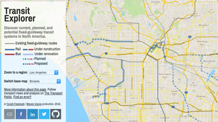
Where are these mythical pedestrian oases-to-be? A site called Transit Explorer, created by urbanist writer Yonah Freemark, uses OpenStreetMap data to visualize all of North America’s “fixed-guideway transit” options, meaning metro and commuter trains, and bus rapid transit. It collects current, planned, and proposed transit routes, showing exactly which cities are thinking about public transportation, and which already have extensive coverage.
It’s a neat way to explore the future of public transportation, especially in cities not normally thought of as pedestrian havens. Indianapolis doesn’t have any current subways or commuter trains, but might soon get a 28-mile, $100 million bus rapid transit line. On the map, it’s easy to see what a difference that could make for the city’s mobility options. Los Angeles, long thought of as a strictly car city, is in the process of adding several new transit lines that would connect the city’s downtown with outlying areas, and even more have been proposed. With Transit Explorer, you can also compare America’s often lackluster train options with the renovations and extensions planned in Canadian and Mexican cities like Mexico City and Toronto.
[h/t: The Map Room]
