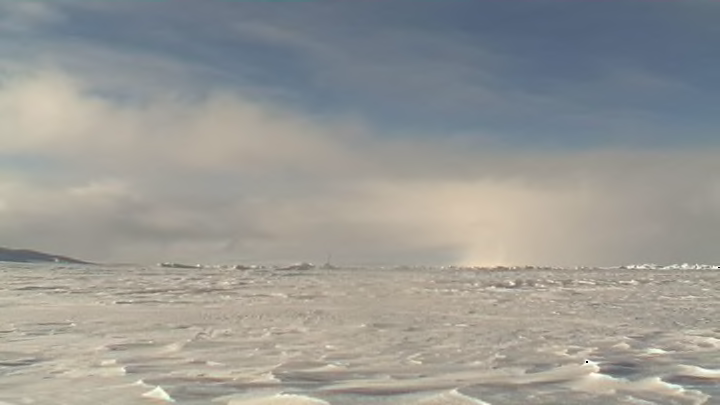
Poor Santa. If he listened to the frenetic social media coverage of last week’s storm in the Arctic, he probably invested in a few dozen houseboats for his elves even before he landed back at home on Christmas evening. An unusual storm in the far northern Atlantic Ocean brought above-freezing temperatures to the North Pole for a brief time on Wednesday, December 30, 2015. The storm was indeed unusual, but in the North Pole, at least, it wasn’t quite as horrific as many people thought.
To say that temperatures in the far northern latitudes around this time of the year are bitterly cold is an understatement. Average temperatures during the near-constant darkness of winter are many dozens of degrees below zero Fahrenheit, and it’s this natural refrigeration source that provides the Northern Hemisphere its worst cold spells when tendrils of the much-ballyhooed polar vortex dip southward and make us complain for days on end. (Though just last month we complained that the weather was abnormally warm.)
When we talk about low-pressure systems, most of the time we’re talking about an “extratropical cyclone,” or one that has features like cold and warm fronts swirling around the circulation. These systems feed their energy off of the jet stream, which can force enormous amounts of air to lift from the surface into the upper levels of the atmosphere, leaving less air (and thereby lower air pressure) at the surface.

Mean sea level pressure between Saturday, December 27, 2015 and Monday, January 4, 2016, as forecast by the GFS model, showing the progression of the low from Texas to the Arctic Ocean. Image credit: Tropical Tidbits
In the last couple of days of 2015, the strong winds of the jet stream lined up just right to allow a powerful low-pressure system to develop near Iceland. The cyclone—the origins of which you can trace back to Texas, where it would go on to spawn severe thunderstorms and flooding rains over the central United States—rapidly strengthened, reaching a minimum central pressure of 928 millibars, according to NOAA’s Ocean Prediction Center. Standard sea level pressure is 1013 millibars, and 928 millibars is a reading one would normally see in a powerful hurricane.

Forecast surface temperatures for 0600 UTC Wednesday, December 30, 2015, from the GFS model on Tuesday, December 29, 2015. Image credit: Tropical Tidbits
A storm this intense was able to move vast amounts of air in short order. In addition to the dangerous flooding, high waves, and damaging winds the system brought to the United Kingdom along its cold front, the counterclockwise winds spiraling around the low dragged a warm front all the way up to the North Pole, sending surface temperatures 50°F to 60°F above where they should be at the end of December.
According to the Washington Post’s Capital Weather Gang, a buoy located about three degrees latitude—or roughly 160 miles—south of the geographic North Pole recorded a high temperature of 33°F on December 30, which is a jump of more than 50°F in 24 hours, and a reading one typically wouldn’t see in this part of the world until the middle of the summer.
This kind of a polar heat wave is somewhat akin to those storm systems that sweep through the middle of the United States during the cooler months, raising temperatures to unseasonable levels for an afternoon before a cold front sweeps through and plummets you into a deep freeze. However, those are much more common than this Arctic storm, the likes of which are exceedingly rare.
While there is mounting evidence that the Arctic is warming, a sudden warm-up like the one seen in the penultimate day of 2015 was a fluke, a statistical blip that’s exciting in a nerdy way and thankfully has no lasting consequences beyond giving us some cool data and probably some very confused polar bears. The flash of warmth was so brief that it likely didn’t have time to melt even the snow or ice sitting on the surface—let alone larger chunks of ice—so fear not, the ice caps (and Santa’s workshop) are safe and characteristically chilly … at least for the moment, anyway.
