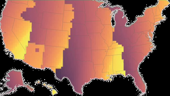
Daylight saving time was created to benefit Americans, but not every part of the country is affected equally. Within the Eastern time zone, for instance, the sun rises a whole 40 minutes earlier in New York City than it does in Detroit. To illustrate how daylight saving time impacts sunrise and sunset times around the county, cartographer Andy Woodruff published a series of helpful maps on his website.
Below, the map on the left depicts how many days of reasonable sunrise time—defined as 7 a.m. or earlier—each part of the country is getting. The regions in the yellow sections have the most days with early sunrises and the darker parts have the fewest. On the right, the second map shows how many sunsets past 5 p.m. we’re getting each year, which appear to be a lot more abundant


Next, he visualized what these sunrise and sunset times would look like if daylight saving were abolished completely, something many people have been pushing for years—and very well could happen in the near future. While our sunset times remain pretty much the same, the mornings start to look a lot sunnier for people all over the country, especially in places like West Texas.
And for those of you who were curious, here’s what America would look like if daylight saving time were in effect year-round. While mornings would look miserable pretty much everywhere, there’d at least be plenty of sunshine to enjoy once the workday was over.

You can tinker with an interactive version of the daylight saving map on Woodruff’s blog.
A version of this story ran in 2015; it has been updated for 2023.
