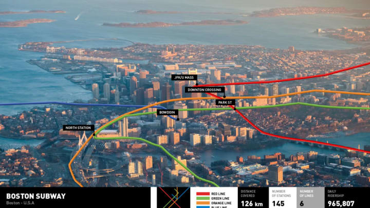
Those who take the subway to work would probably agree that it is neither an especially enjoyable experience nor very pleasant to look at. Things can seem a lot grittier and grimier underground, even when you happen to be in a perfectly charming city with reliable and speedy metro lines.
To give us a different perspective, a creative team commissioned by QuickQuid and an expert in urban planning and design joined up to create aerial images of some of the world’s oldest metro transit systems. The team traced metro lines onto aerial photos of six different cities, and the result is surprisingly beautiful and informative.
For the directionally challenged, it’s also a practical way of visualizing where exactly you are when you breeze through subway stops on your usual route home. “Part of the mystery of traveling underground is that most of us don’t really know where we are in relation to the surface when using the metro,” the team wrote on QuickQuid's website.
Six cities, in six countries total, are featured: Boston, Glasgow, Berlin, Tokyo, Moscow, and Mexico City. One of the more surprising aspects is just how much ground is covered. Moscow’s metro lines, for instance, cover 238 miles, making it one of the world's longest systems. Glasgow’s “Shoogly Train,” by contrast, has just 15 stations spanning 6.5 miles.
QuickQuid’s website has some interesting (and bizarre) information about the history of each metro transit system as well. “Before the underground opened in 1935, the first passenger train driver spent days practicing driving around the city with a Stalin-shaped dummy on board ahead of welcoming the Soviet leader ... as the metro’s first official passenger,” QuickQuid writes.
Scroll down to see all six aerial images, and check out QuickQuid’s website for more details.


