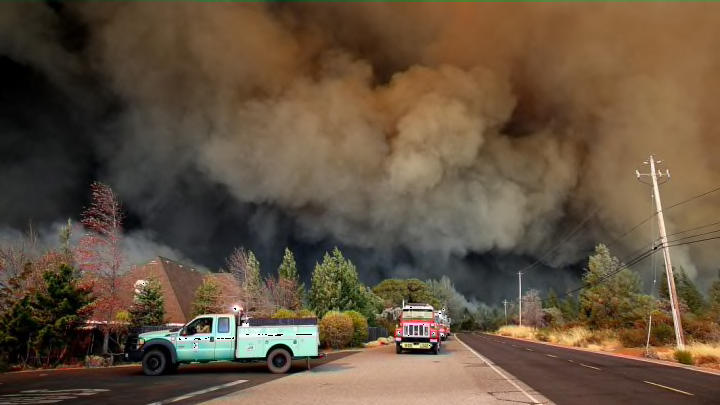
Smoke from the deadly California wildfires has drifted 3000 miles across the U.S., causing hazy conditions in several East Coast cities, the PhillyVoice reports. Smoggier-than-average skies have been reported in Philadelphia, New York City, and other areas along the east coast.
New Jersey-based meteorologist Gary Szatkowski tweeted a map from the National Oceanic and Atmospheric Administration (NOAA), which illustrates the path the California wildfires' smoke likely took. The agency uses satellite technology and a high-resolution atmospheric model to track wildfires and forecast the direction that smoke is expected to travel. To check it out for yourself in real time, visit NOAA’s High-Resolution Rapid Refresh Smoke feature.
So if you thought it was just a bit hazy this afternoon, we have a California fire smoke plume moving through. pic.twitter.com/PsYNlAWrgA
— Gary Szatkowski (@GarySzatkowski) November 19, 2018
Wow. I knew tonight’s sunset over New York City seemed different, and I should’ve realized! Wildfire smoke is in the air, all the way from California. Observation and map via @GarySzatkowski + my photo along the Hudson River. #NYwx pic.twitter.com/8OHxx6QNsw
— Kathryn Prociv (@KathrynProciv) November 19, 2018
Although this news may be alarming to people in East Coast cities, the smoke is likely to disperse as it continues to travel east, if it hasn't already done so. It isn't expected to cause any health problems in the region, National Weather Service meteorologist Lamont Bain told Dallas News.
In California, however, the air quality is currently as bad as Beijing’s. Wildfire smoke produces isocyanic acid (a toxic substance found in cigarette smoke) among other potentially harmful compounds that are still being researched. Wildfire smoke is potentially responsible for 25,000 deaths per year.
“The biggest health threat from smoke is from fine particles,” the EPA states. “These microscopic particles can penetrate deep into your lungs. They can cause a range of health problems, from burning eyes and a runny nose to aggravated chronic heart and lung diseases. Exposure to particle pollution is even linked to premature death.”
People are advised to limit their time outdoors when the air quality is poor. This is especially true for at-risk groups, including children, the elderly, pregnant women, diabetics, and those with heart or lung disease.
[h/t PhillyVoice]
