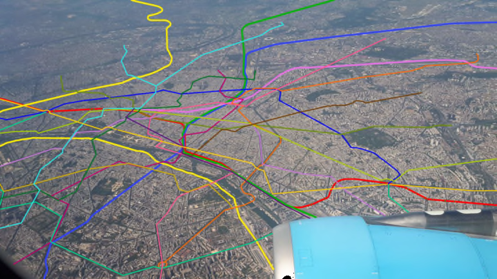
In cities around the world, subways form massive networks that snake under the urban landscape, creating systems that we're familiar with seeing in the form of colored, intersecting lines on a poster, but basically can never see from above ground.
Luckily, the cartography and transit nerds of the internet have you covered. A number of users on Twitter, Tumblr, and forums like Reddit's r/MapPorn have created image mashups of subway lines overlaid with aerial images of urban environments, showing what cities would look like from above if their massive transit networks were above ground. CityLab recently collected some of the most compelling ones, and they're fascinating to examine. (The one above, of Paris, was created by Reddit user Dadapp94.)
Below are a few of our favorites:
Here's London:
I've updated it with overground, DLR and even @wlooandcityline lines. pic.twitter.com/TQsDEQHLMg
— Martin "the mapprentice" Bangratz (@MartinBangratz) June 25, 2018
And New York:
View this aerial illustration of the NYC subway system made by a Tumblr map maven https://t.co/kGzCnEiCdC pic.twitter.com/yyLecgDxZe
— Brooklyn Magazine (@brooklynmag) April 21, 2016
Here's one of Amsterdam that was posted to r/MapPorn by Reddit user Conducteur:

And one of Milan, posted by Reddit user medhelan:

To see more aerial shots like this, head over to CityLab. And if you love aerial images of infrastructure as much as we do, we also recommend these photos of airports seen from above.
