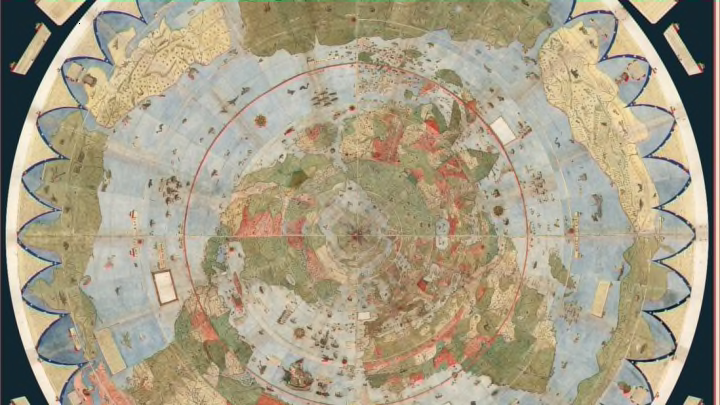
The challenge of designing an accurate, detailed world map has stumped cartographers for centuries, but Urbano Monte got pretty close to achieving perfection in 1587. Now, for the first time, his full 10-by-10-foot world map has been assembled and digitized, Co.Design reports.
There are only two copies of the map: one in Milan, Italy and the second, digitized one at the David Rumsey Historical Map Collection at Stanford University. The massive, extremely detailed illustration, which comprises 60 hand-drawn sheets, is the largest known early map in the world. The Italian cartographer drew it using the azimuthal equidistant projection, which depicts the flattened globe with the North Pole at its center. According to Monte, this gave a more accurate view of the Earth than the Mercator Projection, which was published just two decades earlier in 1569.
The map's depth of detail becomes more apparent the longer you look at it. In addition to country names and geographical landmarks, Monte took the time to note information on weather, meteorological events, length of days at different latitudes, world leaders, and significant countries and places.

To view the completed map in all its glory, you can download the 3D image through Google Earth or view it through Apple’s augmented reality app AR Globe.
[h/t Co.Design]
