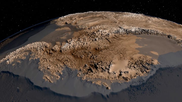
You may know that the South Pole sits on solid land and the North Pole is but a spot in the Arctic Ocean, but it’s probably difficult to imagine either pole as anything but a giant sheet of ice.
But if you've ever wondered what the land underneath Antarctica’s ice—the largest ice sheet on Earth—actually looks like, NASA and the British Antarctic Survey have the answer. Using satellite imagery, sensor records, and data collected by NASA’s Operation IceBridge, which surveys the world’s polar zones by air, the British researchers compiled a stunning map of the southern continent without its frozen mantle [PDF].
The image, dubbed Bedmap2, gives scientists a clear picture of Antarctica's ice-free geology. It also reveals new topographical superlatives. According to a statement from the British Antarctic Survey, the continent’s new deepest point, located beneath Byrd Glacier, is an astounding 9416 feet (2870 meters) below sea level, about 1300 feet (400 meters) deeper than the previous record. It’s also the lowest point ever found on any of the planet's continental plates.
“Before, we had a regional overview of the topography,” Peter Fretwell, a cartographer at the British Antarctic Survey, said in the statement. “But this new map, with its much higher resolution, shows the landscape itselfa complex landscape of mountains, hills and rolling plains, dissected by valleys troughs and deep gorges.”
A version of this story ran in 2013; it has been updated for 2023.
