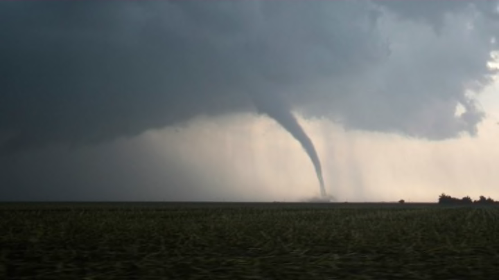
Oklahoma City holds the dubious distinction of being the unofficial Tornado Capital of the United States. The U.S. city has endured more tornados than any other—149 officially recorded since 1890, as far back as National Oceanic and Atmospheric Administration records go.
The Oklahoma City metro area has been ravaged by no less than six tornados in the past month (five recorded this past week alone in and around El Reno, OK), which altogether have caused almost three dozen deaths and major property damage. Moore, Oklahoma—a suburb just 10 miles south of Oklahoma City—got slammed by no less than five major tornados since 1998, two of them categorized as mighty EF5s: the devastating tornado that struck last month, and one in May of 1999. With winds clocked at 318 miles per hour, the latter is considered to be the strongest tornado ever recorded worldwide.
Why does the Big Friendly steal the thunder?
The answer is complicated, because there is still a lot we don’t know about the inner workings of tornados. Where they touch down is not an exact science, and much of the research meteorological scientists have conducted has shown that twisters don’t seem to be very picky about where they show up and when. Pure coincidence may be all we can blame.
What we do know is that the unique geography of the continental United States makes it more susceptible to tornados than the rest of the world, particularly in the central plains region the media refers to as “Tornado Alley”—which plays doormat to roughly a quarter of the strongest tornados recorded. Tornados are the spawn of the lurid meteorological embrace of cool, dry Rocky Mountain air moving southeast and warm, humid Gulf air moving northwest that meet over the country’s midsection, most notably over that swath of the plains that extends from Iowa south to northern Texas.
The rotating mix of air currents forms giant supercell thunderstorms that tend to breed tornados, and Oklahoma City appears to be smack dab in the middle of it. The local terrain certainly helps—there aren’t many large bodies of water nor are there mountainous regions in the area that can complicate tornado formation. Large rivers, great lakes or proximity to the ocean can potentially cool warm air, which may ease the severity of thunderstorms that form downwind of these bodies of water. Mountains too can have a similar deterring effect. But these two landscape characteristics do not absolutely protect a region from tornados, as many myths have perpetuated. Tornados recorded in places like Maine, Washington state and the New York City area are stark evidence of that.
The NOAA estimates that there are 1300 tornados in the United States on average each year, more than anywhere else in the world. Around 55 of them roar through the state of Oklahoma.
Other Tornado Hotbeds
Tornados have been reported all over the world, and some of the world's most tornado-prone areas are in regions with similar combinations of geographical, topographical and meterological conditions to those of Tornado Alley.
Dixie Alley
The lower Mississippi valley from Texas east through Louisiana, Alabama, Mississippi, Georgia, and South Carolina, and as far north as Missouri, Tennessee, and Kentucky, has lately been seeing a lot of tornado activity. Tornados in Dixie Alley tend to occur in the fall when the jet stream from the Gulf pushing warm, moist air is more powerful, and often come at night and/or wrapped in blinding rain, making them more difficult to detect and thus potentially more deadly than Tornado Alley storms. Notable Dixie Alley twisters include the 2011 storms that hit Tuscaloosa, Alabama (EF4) and Joplin, Missouri (EF5)—considered the deadliest tornado the United States has ever endured.
Florida
According to NOAA data, between 1991 and 2012, Florida averaged 66 tornados annually, behind just Texas (155) and Kansas (96). The Sunshine State, however, gets more press for its susceptibility to destructive tropical storms and hurricanes, as well as frequent thunderstorms. All of these can and often do spawn tornados when they move over the peninsula. They don’t get much notice because they are typically weak funnels.
Serranias del Burro
The Coahuila state of Mexico is home to the Serranias del Burro, the mountainous region that makes up the northern lobe of the Sierra Madre Oriental mountain range. It is prone to supercell thunderstorms that spawn tornados similar to those observed in Tornado Alley. Typically though, these storms cross the border (over the Rio Grande) into the U.S. and produce tornados there.
Canadian Tornado Alley
Tornados occur most frequently in the strip of southern Canadian provinces that border the United States. Provinces east of the Canadian Rockies like Alberta, Manitoba, and Saskatchewan, which can still get a breath of that warm Gulf air, are susceptible. Ontario gets another kind of licking, particularly in the south in the summertime, due to the cool breezes that blow off the Great Lakes and interact with warm summer air.
Bangladesh
Nestled at the head of the Bay of Bengal, this sea-level southeast Asian country is prone to tornados and cyclones much like Dixie Alley and Florida. A tornado that hit the cities of Daulatpur and Saturia in 1989 is widely considered to be the deadliest tornado in history, having killed as many as 1300 people. Bangladesh has the unfortunate distinction of being both one of the most densely populated countries in the world, and one of the most tornado-prone—so when tornados strike, they can be far more deadly than in other areas.
Elsewhere in the world, Argentina, South Africa, and Russia are also notable spots for tornado outbreaks, but lack of organized record-keeping makes it hard to determine the extent of their frequency.
