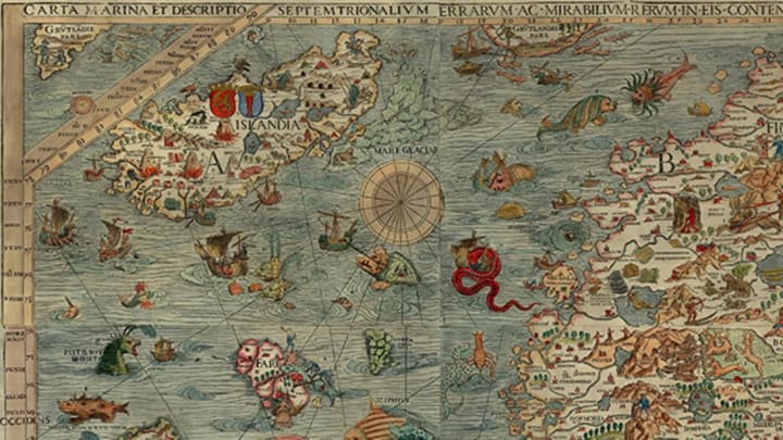
The most eye-catching part of centuries-old maps are often not geographical; they’re supernatural. Tucked between bloated continents and far-flung islands, Medieval and Renaissance mapmakers sketched spirited drawings of mythical sea monsters. What was it that made the illustrated seas so terrifying?
It was part decoration, part a declaration of ignorance, as a new episode of PRI’s The World discusses.
“In the Medieval and Renaissance period in Europe, people didn't really know what was out there,” Dory Klein, an educator from the Boston Public Library’s maps division, tells the show. "So your corpus of knowledge came from folklore and the Bible. And so in that world, monsters could very well be real and they were just part of this supernatural landscape.”
Instead of letting the known world blur into blank space as cartographers reached the limits of contemporary geographical progress, they inserted scary monsters as visual signals both that they had no idea what was really out there, and yes, it might be kind of dangerous.
You can dig deeper into cartographic monsters each week by following the #mapmonstermonday hashtag on Twitter and Instagram.
Listen to the episode from PRI here.
[h/t PRI]
