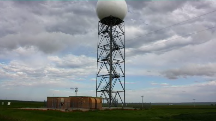
What would we do without weather radar? This accidental discovery revolutionized the way we look at the weather and it has helped save countless lives over the past six decades. Its uses range from watching light rain slowly lumber toward you to tracking the precise location of a tornado tearing through towns hundreds of miles away. Weather radar is an incredible piece of technology, and knowing how to interpret the colors on the map can keep you safe as we enter severe weather season.
HOW IT WORKS
Troops on the front lines during World War II discovered that the radar they used to track incoming enemy aircraft also detected precipitation, giving them the ability to keep watch over both storms and airplanes. Meteorologists studied this phenomenon once the war was over, and developed this technology into a tool we use every day.
The United States has more than 120 weather radar sites around the country continuously keeping an eye on the skies to keep us safe no matter what pops up on the horizon. Weather radar consists of a rotating dish protected by a large white dome; this dish sends pulses of energy (the radar beam) into the atmosphere to detect objects like rain or hail. If the radar beam encounters an object, some of the radiation will bounce off of it and return to the radar site.
PRECIPITATION
A radar image of Hurricane Katrina as it came ashore east of New Orleans on August 29, 2005. (IMAGE: Gibson Ridge)
The strength of the return beam and the time it takes for the pulse to return to the radar dish allows us to see how heavy the precipitation is and how far away it is from the radar site. The resulting data is displayed on a map using a rainbow scale that typically spans from light blue to dark red and purple, with cooler colors indicating lighter precipitation and warmer colors showing heavy precipitation. Solid batches of oranges, reds, and purples on a radar image usually indicate an intense thunderstorm.
A recent development in radar technology called "dual polarization" allows the radar to send out two beams of energy—one that is oriented horizontally and another oriented vertically. This dual radar beam allows us to see the size and shape of the objects falling through the atmosphere. This is important as it can tell us the difference between rain, hail, snow, sleet, and foreign objects like tornado debris. The National Severe Storms Laboratory calls this "the most significant enhancement ever made to the nation's radar network since Doppler radar." (Doppler radar detects an object's velocity, as explained below.)
The only downside to dual polarization technology is caused by the Earth itself. As the radar beam gets farther away from the radar site, it climbs higher off of the ground due to the curvature of the Earth. Once the beam is a few dozen miles away from the radar itself, it can only detect precipitation more than 10,000 feet above the surface—too high to get an accurate read of what’s happening closer to the ground.
VELOCITY
A side-by-side view of the Tuscaloosa-Birmingham tornado on April 27, 2011. The left panel shows precipitation, including the ball of debris in the tornado itself, while the right panel shows the winds within the storm. (IMAGE: Gibson Ridge)
Arguably the most important feature of weather radar is its use of the Doppler effect, which gives the radar the ability to detect how fast precipitation is moving in a certain direction—in other words, it shows us the wind. The National Weather Service started putting this to use in the 1980s, allowing us to see damaging wind gusts and tornadoes developing within a thunderstorm.
Severe weather coverage on television often uses velocity imagery to help meteorologists and viewers figure out where a tornado is most likely to occur within a severe thunderstorm. Velocity imagery usually consists of red and green colors; red colors usually indicate wind moving away from the radar site, while green shows wind moving toward the radar site.
When the red and green colors are very close together within a thunderstorm, this is called a rotational couplet, and this is where a tornado is most likely happening. The couplet in the right panel of the radar image above shows the winds swirling around the intense EF-4 tornado that struck Tuscaloosa and Birmingham, Alabama, on April 27, 2011.
NON-PRECIPITATION RETURNS
Radar isn’t only useful for finding precipitation. You can also use this technology to spot tornado debris. This serves as an incredible advance notice to confirm tornadoes when it would have been otherwise impossible because of heavy rain or lack of sunlight. Radar can also spot plumes of smoke from wildfires, swarms of insects, flocks of birds, frontal boundaries (like cold fronts and sea breezes), and even tragedies like the disintegration of the Space Shuttle Columbia over Texas in 2003.
Radar has become such a ubiquitous feature of meteorology, it feels like it has been around forever. It's good to remind ourselves that it's an ever-evolving technology, one with future applications we cannot yet predict.
