Find Out What Solar Power Would Save You Using Google Maps

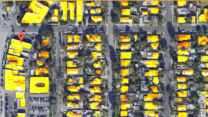
Due to factors like weather, shade, and building design, solar power isn’t a one-size-fits-all solution for every home. To help potential solar users understand how these conditions would affect their ability to use solar power, Google launched their Project Sunroof initiative in San Francisco, Fresno, and Boston this summer. Now, they're expanding the technology to include cities in the nine most active solar states in America.
Utilizing data available on Google Maps, the program is able to calculate how much roof space a building has available for solar panels. It combines this data with the yearly amount of sun your roof receives—accounting for nearby obstructions and local weather patterns—to calculate how much switching to solar would save you in the long run. From there, the service can even point you in the direction of a solar panel installer near you.
This kind information is crucial to homeowners considering going solar, a decision that could easily cost them more than $10,000, though a variety of government incentives, including tax rebates and credits, are available that may bring that cost down. Of course, after the big initial investment, installing solar panels can also save average homeowners more than $20,000 down the road—assuming there isn't a huge tree in your yard blocking half the day’s sunlight. Project Sunroof is now available in metro areas in California, Massachusetts, Arizona, Connecticut, Colorado, New York, New Jersey, Nevada, and North Carolina.
[h/t: The Verge]