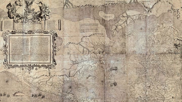
Cartographers shape how we think about the world. The designers and explorers who create maps influence things like whether we think of North America as above South America or below, how big we think Greenland is. World maps help us create mental images of places we’ve never been, from an aerial view most people will never see.
The bird’s eye view of the Earth that we associate with today's world maps is relatively recent, in the grand scope of human history. Before satellites made it easy to create accurate images of the globe, explorers had to set sail to diligently map out every nook and cranny of the continents. What they imagined Earth looked like from above was often very different from what we would conceive of today. A new book called Map: Exploring the World (Phaidon 2015) is a celebration of cartography, especially rare, centuries-old maps from explorers and cartographical pioneers.

Here are eight early maps that shaped how people imagined geography as early as 1000 years ago:
1. THE FIRST CLIMATE ZONE MAP

Image Credit: MS D’Orville 77, fol.
Created by a Roman scholar in 1000 CE, this map was the first to divvy up the Earth into climactic zones. The cartographer described, in detail, the frigid zones near the Earth’s poles, the hot sun of the equatorial zones, and the temperate climes of the middle areas. It was also one of the first maps to put north at the top, setting the precedent for centuries of northerly bias in mapping.
2. THE FIRST MAP OF THE “NEW WORLD”

Image Credit: Bibliografía: Berwick y Alba, 1892, Documentos Colombinos
Though it hasn't been authenticated, this crudely drawn sketch of the northern coast of Hispaniola is said to have been drawn by Christopher Columbus himself during his first voyage to the Americas in 1492. If it was sketched by Columbus, it’s the earliest surviving map of what Europeans called the New World.
3. THE FIRST MAP OF NORTH AND SOUTH AMERICA

Image Credit: Museo Naval, Madrid, Spain/Bridgeman Images
Drawn by cartographer and navigator Juan de la Cosa, this map from the year 1500 was the first to show the West Indies, Venezuela, Brazil, and Newfoundland.
4. THE FIRST PRINTED STAR CHART

Image Credit: Daniel Crouch Rare Books
German artist Albrecht Dürer is behind this woodcut of the northern hemisphere in 1515. With its southern counterpart, it’s one of the first star charts ever printed. The work contains 48 constellations, along with the figures they represent. The figures are facing away, because they’re designed to look as they would if you were looking down upon them from space.
5. THE FIRST MODERN ATLAS

Image Credit: Library of Congress Geography and Map DivisionWashington, DC
In 1570, Abraham Ortelius debuted the first modern atlas he called "Theater of the World." It was the first book of maps created at a common scale with text explanations. In this map, he added four mythical islands that legend said existed around the North Pole.
6. THE FIRST MERCATOR PROJECTION

Image Credit: White Images/Scala, Florence
Gerard Mercator invented a type of mapping projection that translates the curved surface of the Earth into a flat, 2D image, allowing 16th century explorers to chart their courses more accurately without using a globe. This world map, drawn in 1569, has been a model for maps for centuries, though the projection does distort the size of the northern landmasses.
7. THE FIRST MAP OF THE U.S.

Image Credit: Library of Congress, Rare Book and Special Collections Division/Science Photo Library
This English map, created in 1589, celebrates Sir Francis Drake’s victorious raid over the Spanish at St. Augustine, Spain’s main outpost along the East Coast. It’s the first known map of any part of the United States.
8. THE FIRST CHINESE MAP OF THE WEST

Image Credit: Daniel Crouch Rare Books
In 1602, Italian priest Matteo Ricci teamed up with engraver Li Zhizaoto to combine Eastern and Western cartography in one map of the world, the first Chinese map depicting the western hemisphere. Ricci was the first Westerner allowed in China’s Forbidden City. The two combined as much Chinese and Jesuit cartography knowledge as possible. Because the Chinese viewed their country as the Middle Kingdom, China was placed at the center of the image.
All images from Map: Exploring the World, courtesy Phaidon
