If you love something, let it go. If it comes back to you, it’s yours—but know that cell service might be bad, so you should be patient.
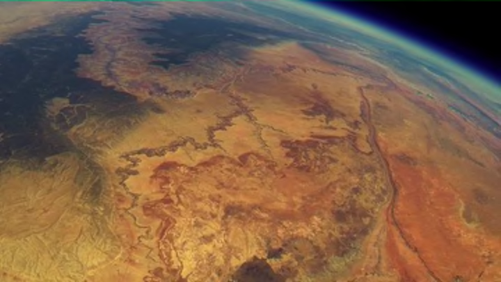
In 2013, a group of friends and students created a 3D-printed frame, loaded it up with a GoPro, charted a course, affixed a weather balloon, and sent it out into the skies about 20 miles west of the Grand Canyon in Tuba City, Arizona.
After nine minutes it was 22,967 feet above the earth. By 23 minutes, its altitude was 37,916 feet. After an hour and 12 minutes, the camera was shooting the blues and golds of the American Southwest from nearly 90,000 feet.
Not that the team was aware of any of this. They never heard back from the device they had programmed to broadcast its landing coordinates. For about two years after launch, they believed they had botched the trajectory, accidentally plunking the device in a dead zone and preventing it from texting its GPS location as planned. Turns out, they had in fact calculated properly, but—according to one of the students—the AT&T service map used in the planning was inaccurate. It wasn’t until a hiker (and AT&T employee!) found the phone some 50 miles away from its liftoff location and took it to a store that the team received the footage.
That hour and 38 minutes of video was then edited down to a four-minute clip, which shows everything from planning, to take-off, to the balloon bursting at the edge of space, and the tumultuous tumble back to earth. You won’t get a better view even from the cockpit of a space shuttle.
[h/t Atlas Obscura]
