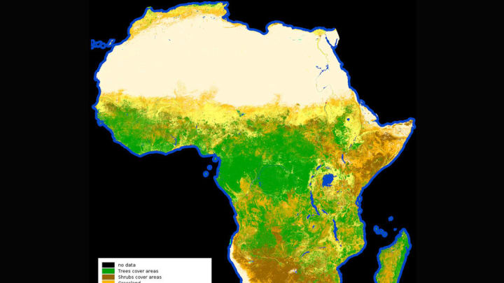
This isn’t just any image of Africa. It represents the first of its kind: a high-resolution map of the different types of land cover that are found on the continent, released by The European Space Agency, as Travel + Leisure reports.
Land cover maps depict the different physical materials that cover the Earth, whether that material is vegetation, wetlands, concrete, or sand. They can be used to track the growth of cities, assess flooding, keep tabs on environmental issues like deforestation or desertification, and more.
The newly released land cover map of Africa shows the continent at an extremely detailed resolution. Each pixel represents just 65.6 feet (20 meters) on the ground. It’s designed to help researchers model the extent of climate change across Africa, study biodiversity and natural resources, and see how land use is changing, among other applications.
Developed as part of the Climate Change Initiative (CCI) Land Cover project, the space agency gathered a full year’s worth of data from its Sentinel-2A satellite to create the map. In total, the image is made from 90 terabytes of data—180,000 images—taken between December 2015 and December 2016.
The map is so large and detailed that the space agency created its own online viewer for it. You can dive further into the image here.
And keep watch: A better map might be close at hand. In March, the ESA launched the Sentinal-2B satellite, which it says will make a global map at a 32.8 feet-per-pixel (10 meters) resolution possible.
[h/t Travel + Leisure]
