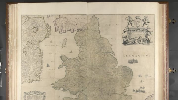
When Charles II took back the British throne in 1660 after the death of Oliver Cromwell, he received a special gift from Johannes Klencke, a Dutch merchant and scholar who was hoping to curry favor for Dutch sugar traders upon the monarch’s return to power. To this day, the enormous Klencke Atlas, now owned by the British Library, remains one of the most impressive atlases in the world. But since you need several people to even have a chance at moving the oversized book, it’s probably better to just look at a digitized copy. Luckily, the map is now viewable online, as Co.Design reports.
When open, the Klencke Atlas stands approximately 7.6 feet tall and 5.8 feet wide. It contains 41 wall maps that represent some of the best Dutch cartography of the 17th century, focused mainly on places Charles would have been interested in, like Britain and the Netherlands, where he had lived in exile.
Most of the maps in the book are in extraordinary condition for their age. Some, like Hugo Allard’s map of Britain, represent the only copy left of their kind.
The investment paid off for Klencke. Charles, a complete map nerd, valued the atlas as one of his most prized possessions, keeping it in his cabinet, and he rewarded Klencke with the title of baronet later that year.
The British Library also owns what’s officially the largest atlas in the world, the Earth Platinum atlas. It weighs 440 pounds and requires a team of six people to carry it. It’s bigger than the Klencke Atlas by a mere 30 centimeters on each side.
The digital copy of the Klencke Atlas is available from the British Library.
[h/t Co.Design]
